Aerial footage shows just how low Danube levels have dropped in and around Budapest
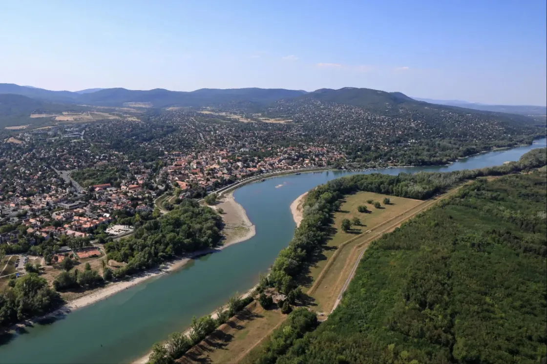



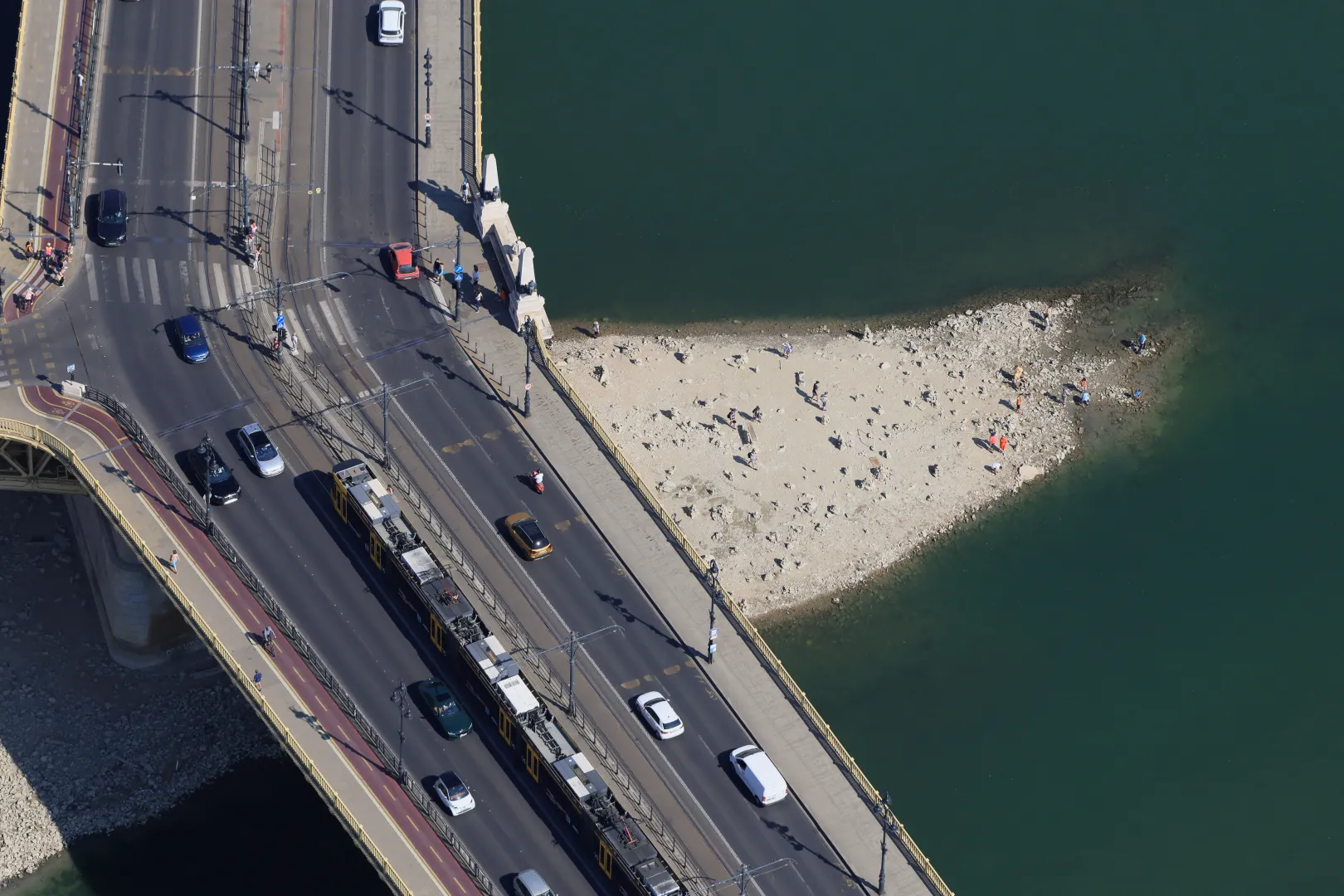
The water level of the Danube river has never been as low in Budapest as it is now. Although the situation may improve minimally towards the end of the week and the prospects are more optimistic now than they were a few days ago, due to the extreme drought, the water level will likely continue to drop in the coming days. Because of the current heat wave, all sorts of interesting objects which had previously been submerged in the Danube have been emerging from the river that runs through the city: the remains of the former Franz Joseph Bridge are now visible beneath Szabadság Bridge; World War II explosive devices have been unearthed from the silt near Batthyány Square; and weapons have been recovered from the river near Margit Island.
The aerial photos taken by photographer Ferenc Sztraka on July 30, along with his commentary provide an overview of what the Danube looks like these days between Budapest and Esztergom.
All sorts of wild rumors have been circulating online about the causes behind the low water levels, but according to a statement from the National Water Authority, the primary cause of the extremely low water levels is typically the lack of precipitation in the watershed, which leads to low natural water yields. And while exploring the now-exposed Danube riverbed might be a tempting adventure, the Budapest Waterworks has strongly urged everyone not to venture into this area either for a sports activity or for other reasons, under any circumstances, as they are typically classified as water protection zones. “If, as a result of human activity (normally not present here), any pollution should occur in these currently accessible areas, the consequences could, in extreme cases, render that particular section of the water source unusable for years or even decades. In other words, that section could be excluded from the process of producing drinking water,” the Budapest Waterworks said.
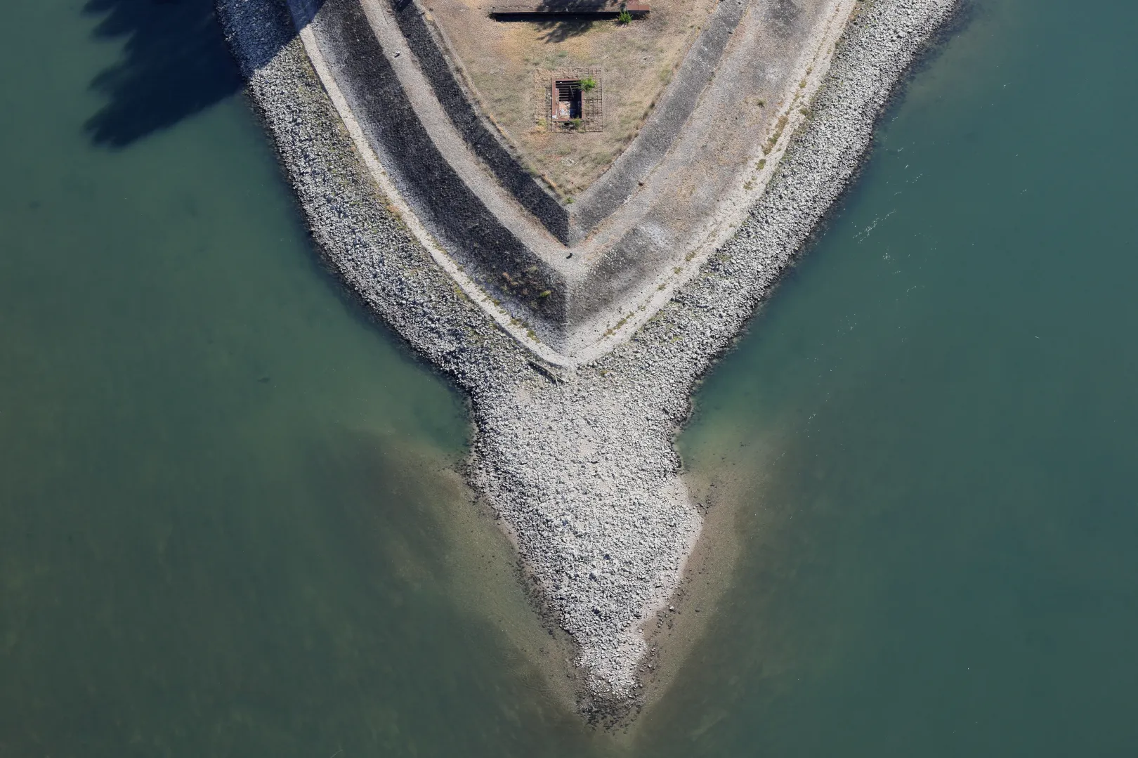
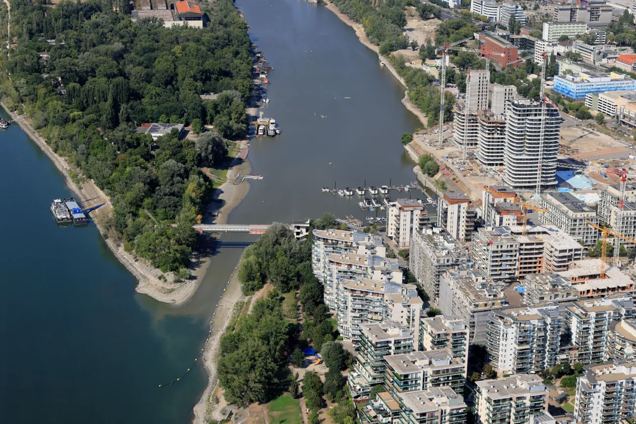
“We flew north along Margit Island. I immediately noticed something interesting: when rivers are confined between levees, it is not easy to tell from the air whether the water level is high or low. Even when the river was flooding, the only clear indication was the strange angle at which the docks’ planks were tilted. “The situation was similar this time as well, except it was the other way around," wrote Sztraka.
In mid-July we reported on the Danube’s water flow being very low—just 835.6 cubic meters per second at the time—and, on top of that, the water’s temperature kept rising. Because of this, experts at the Paks Nuclear Power Plant returned to the continuous monitoring of the river's temperature along the affected section to ensure the safe operation of the plant and compliance with environmental regulations. By 2 August, Prime Minister Péter Magyar announced that the Danube’s water level is just one centimeter away from necessitating a complete shutdown of the power plant. As of Wednesday afternoon, this hasn’t happened yet; the last Paks turbine still in operation continues to generate power.
The highest temperature previously recorded at the wter gauge on the Danube in Budapest was 27.2 degrees Celsius in August 2018; on the evening of June 30 this year, it already reached 28.2 degrees. This coincided with a heat wave peaking at 42 degrees, prompting Minister of Economy and Energy István Kapitány to authorize increasing the maximum temperature limit at the Paks Nuclear Power Plant from 30 to 31.5 degrees to ensure a secure power supply—a measure environmentalists said could only be maintained temporarily.
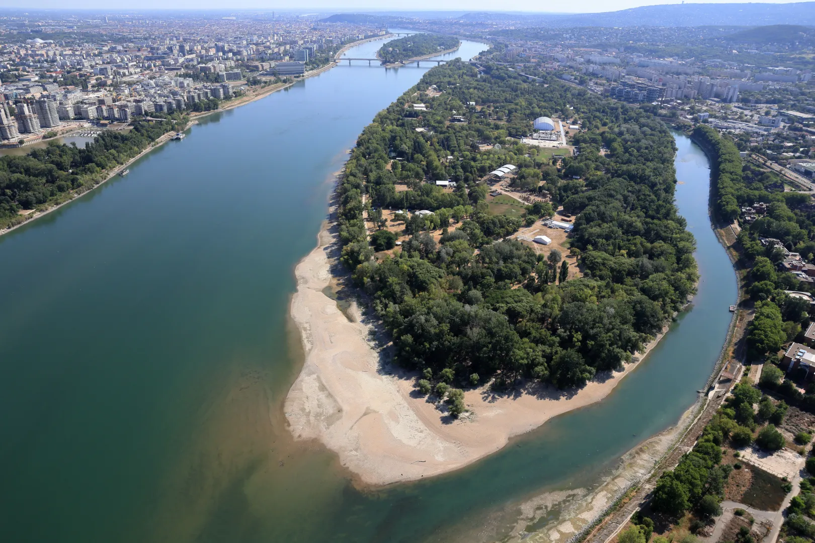
According to Sztraka, as they travelled further from the massive levee that characterizes the Budapest section of the river, the grim reality of the drought immediately became more pronounced. “At the northern tip of Óbuda Island, we were greeted by the sight of a sizable sandbar. It’s quite possible that those attending the Sziget Festival—the stages for which were under construction at the time—will immediately take possession of the sandy beach which will now come as a bonus with their ticket price. During the flight we noticed that a wide strip of sand now encircles each island all the way to Esztergom—and surely beyond as well.
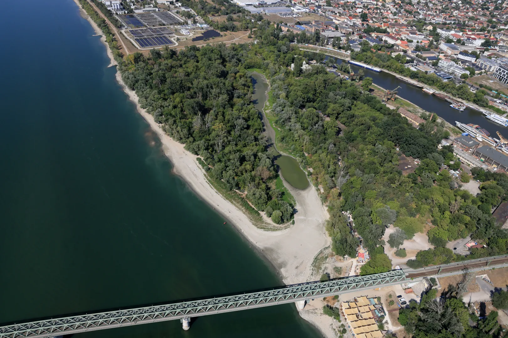
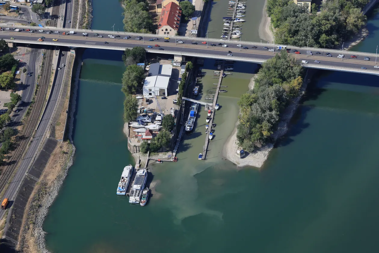
The winter harbor in Újpest, also known as Népsziget Bay, is a 28.6-hectare bay in the capital. It is an important hub of Budapest’s water life and is a favorite destination for anglers and boaters alike.
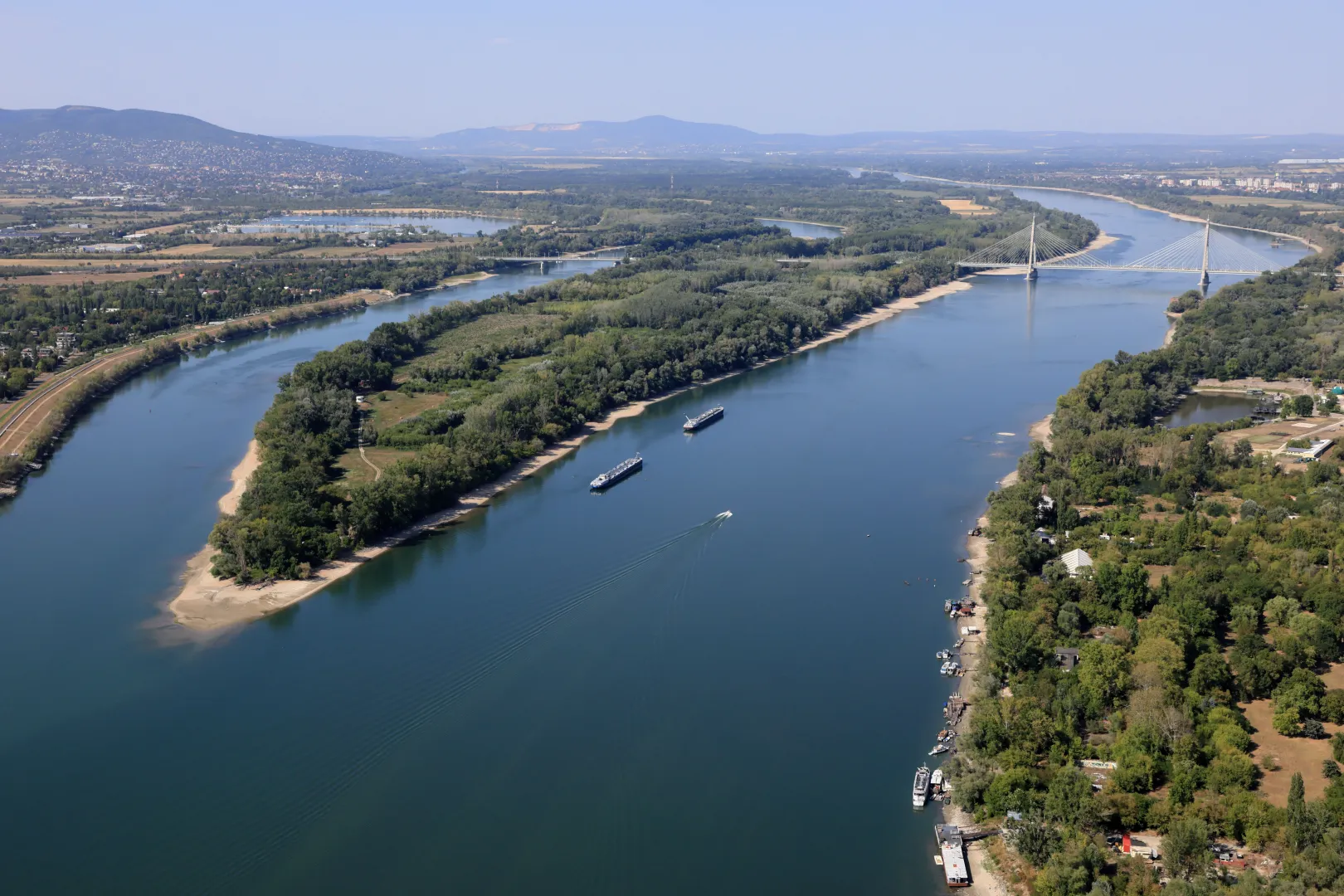
Apart from the two anchored tankers visible near the southern tip of Szentendrei Island, the photographer did not see any bigger sightseeing or cargo ships along the entire route. Due to the extremely low water level, boat traffic has also come to a standstill.
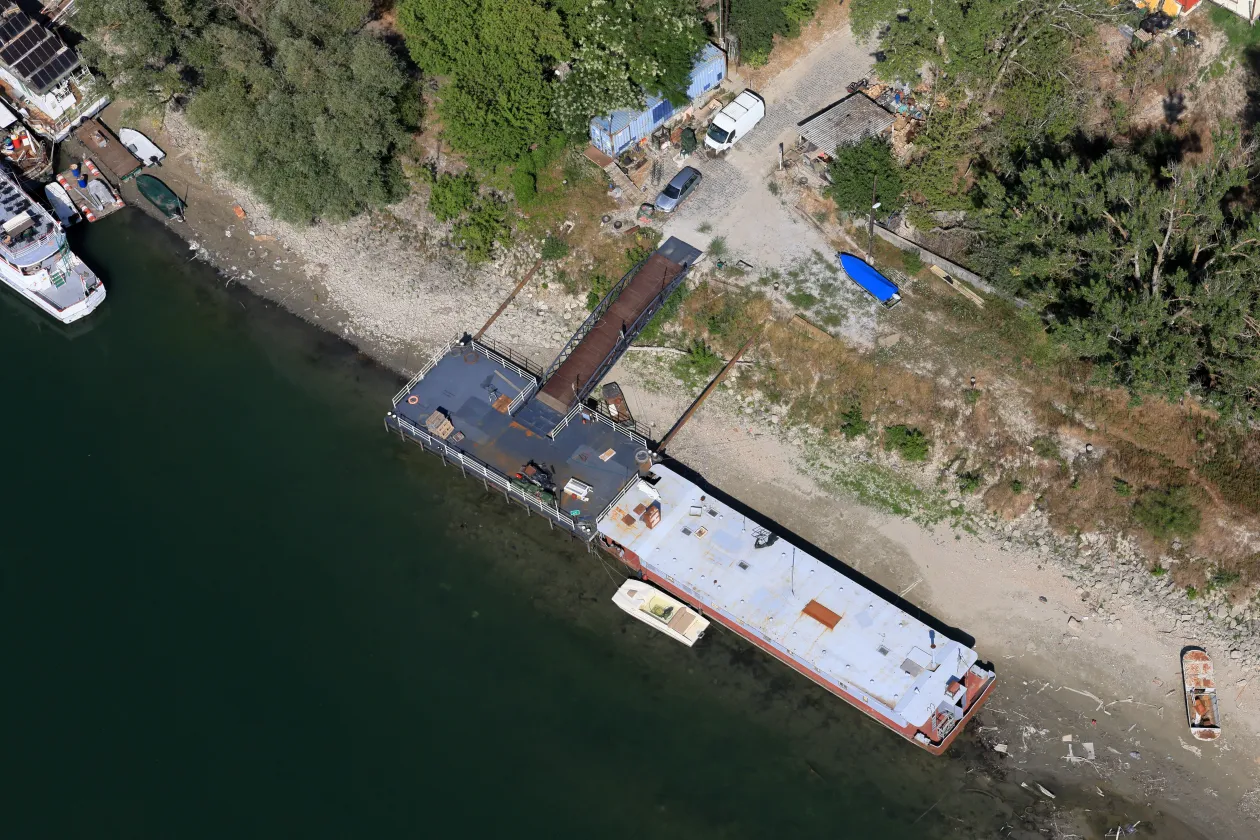
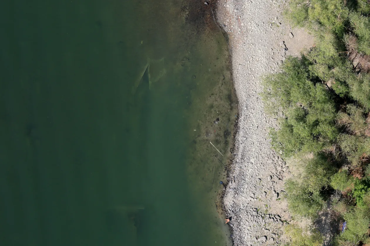
Even at the Dunayacht boating station on Rév Street in Megyer, the water is not deep enough to receive bigger vessels. More than a dozen hotel boats have been stranded along the Hungarian section of the Danube in recent days due to the low water levels, and most cargo ships have also been forced to stay put. The remains of what appears to be a ship have also emerged from the water near Megyer.
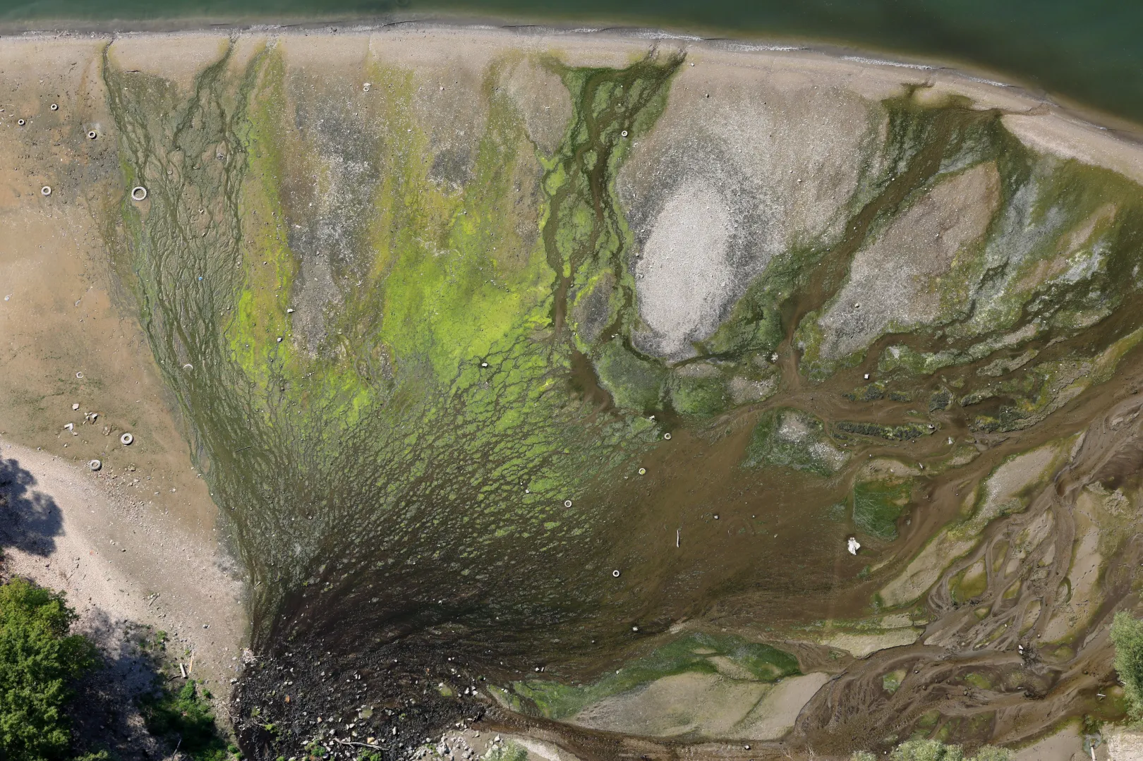
The mouth of the Szilas Stream, located on the south side of the Megyeri Bridge has taken on a rather strange, tropical-like appearance, revealing several-previously not visible-tires scattered across the riverbed.
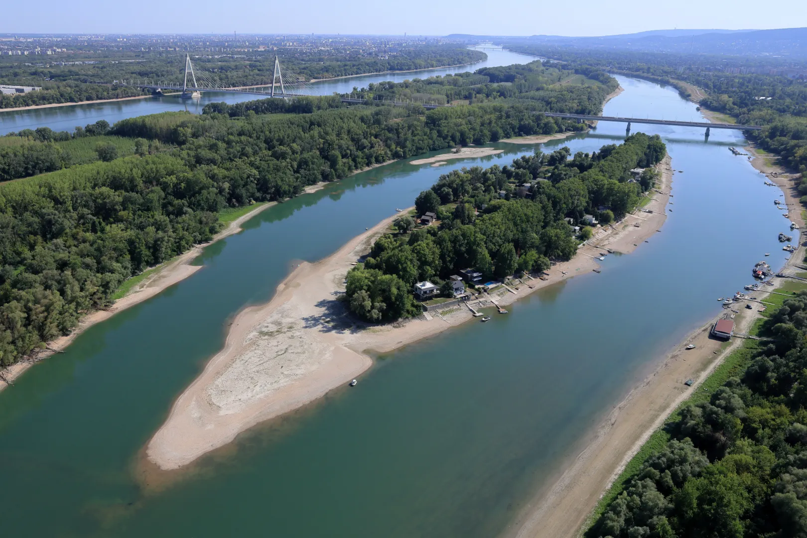
Sediment formation in the river is also clearly visible near Lupa Island.
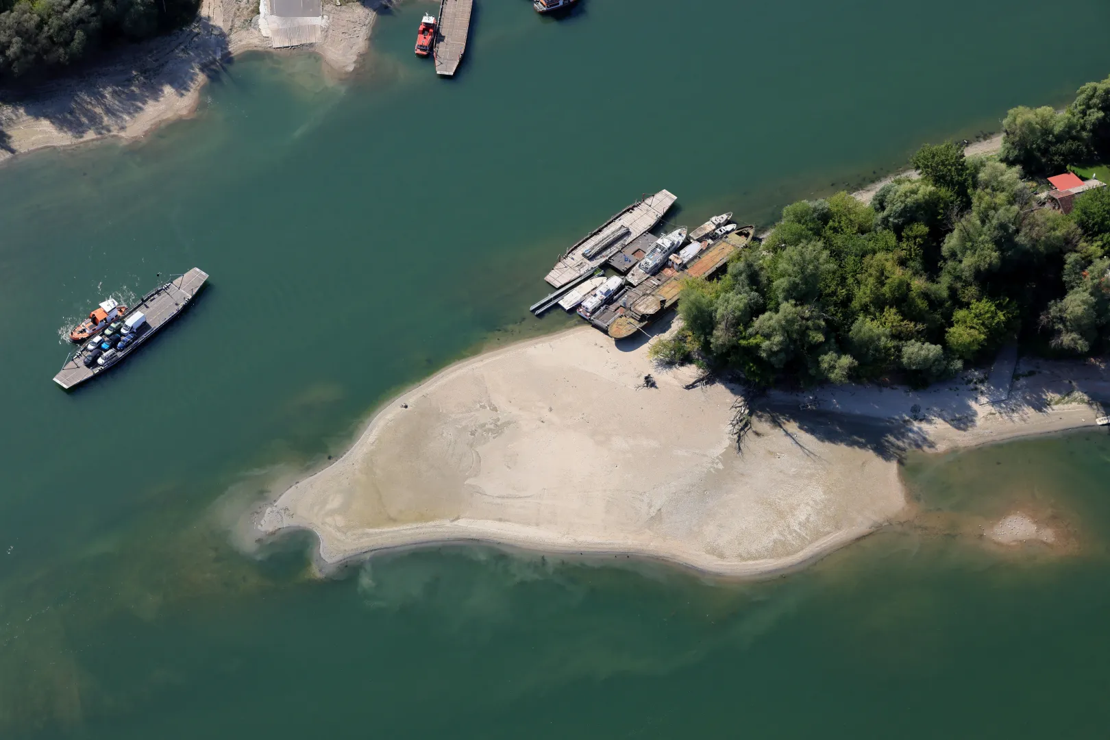
The ferry was still running between Horány and Dunakeszi by Szürkő Island, although some of the boats on the island were already stranded on dry land.
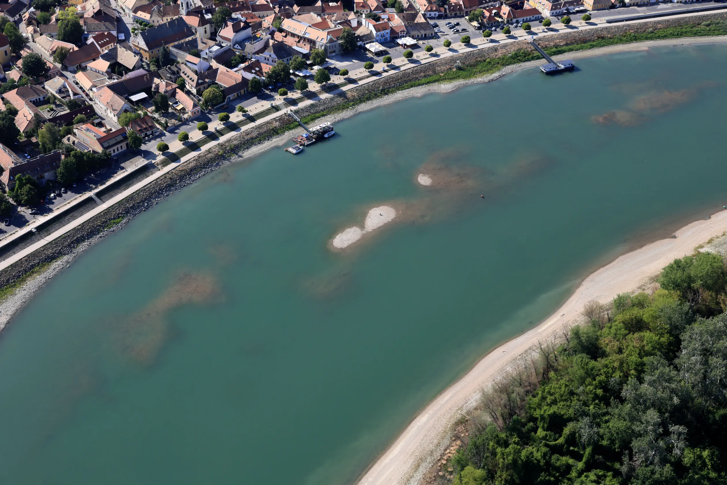
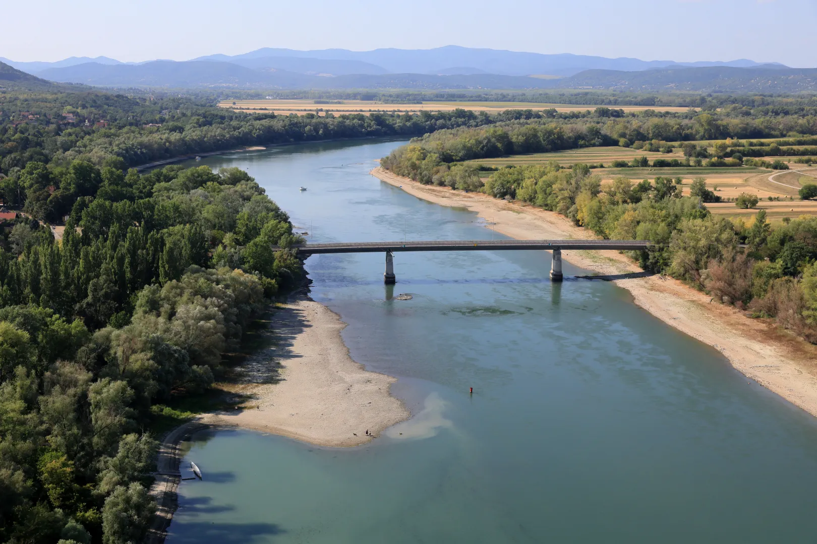
“The Tildy Bridge in Tahitótfalu comes into view suddenly when flying over the Szentendre section of the Danube. Near the bridge, on the side of the island, the exposed sandbar is wider, but at the next bend in the river, the alluvial deposits that have surfaced turn up on the opposite side,” wrote Sztraka.
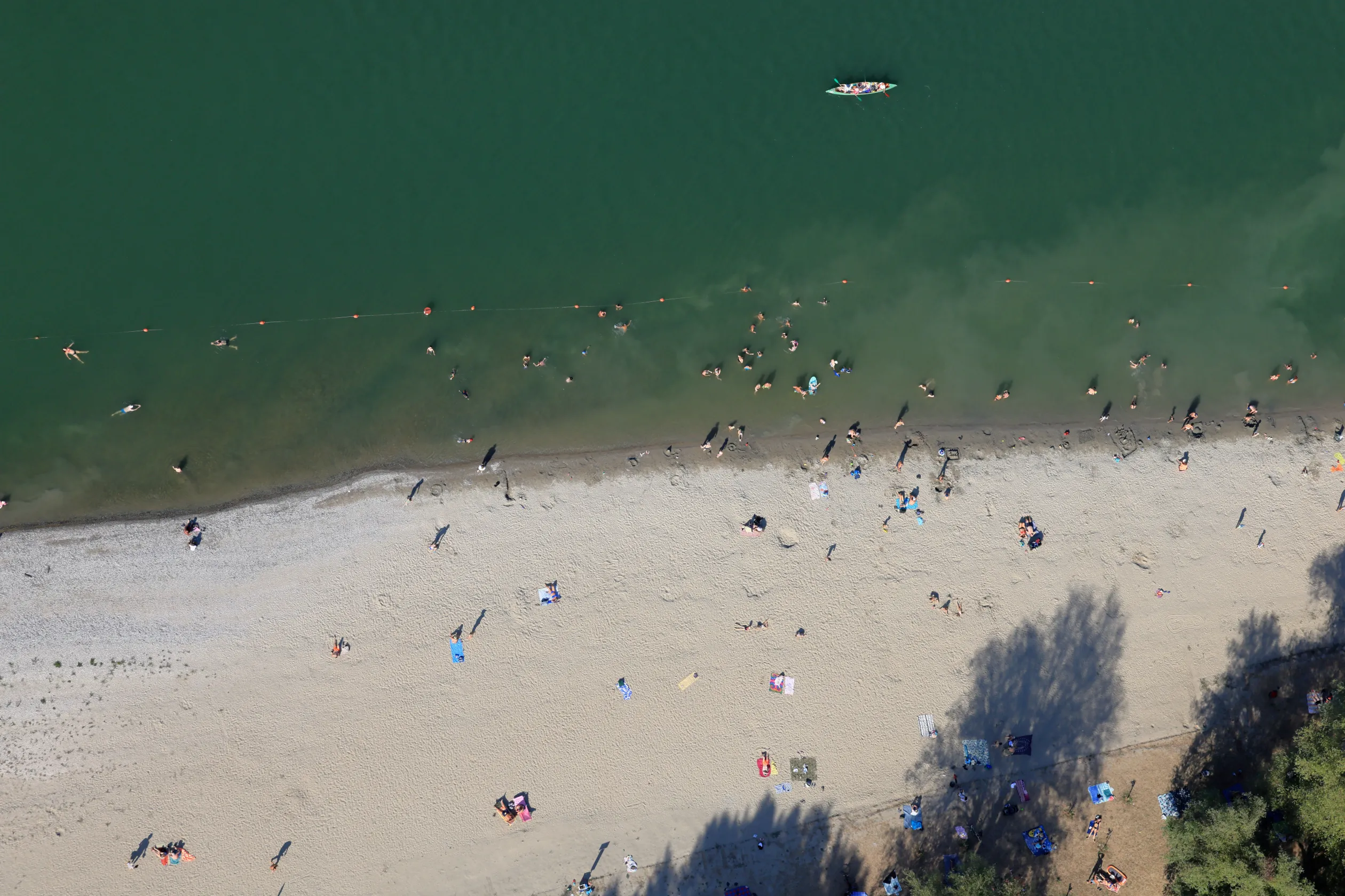
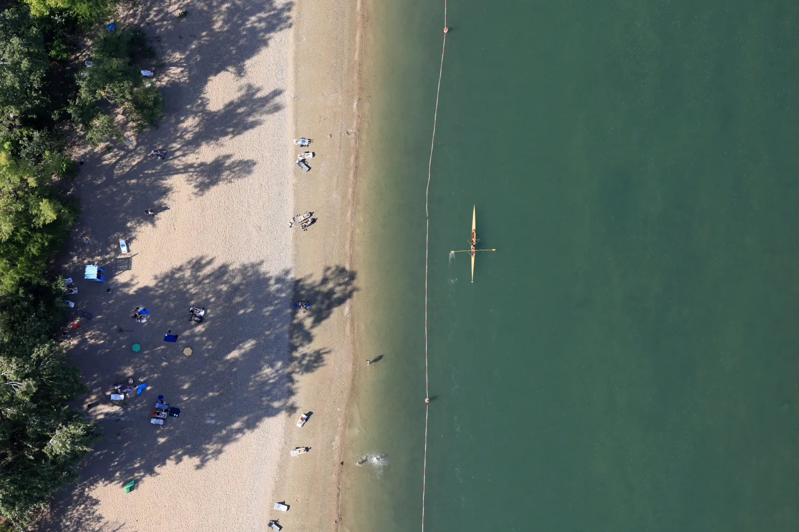
The public beach in Dunabogdány was bustling with activity when the photos were taken. This is the settlement whose residents refused to reduce their water consumption despite repeated warnings—until the ice eventually broke and they began to exercise restraint, which even earned them special praise from the waterworks.
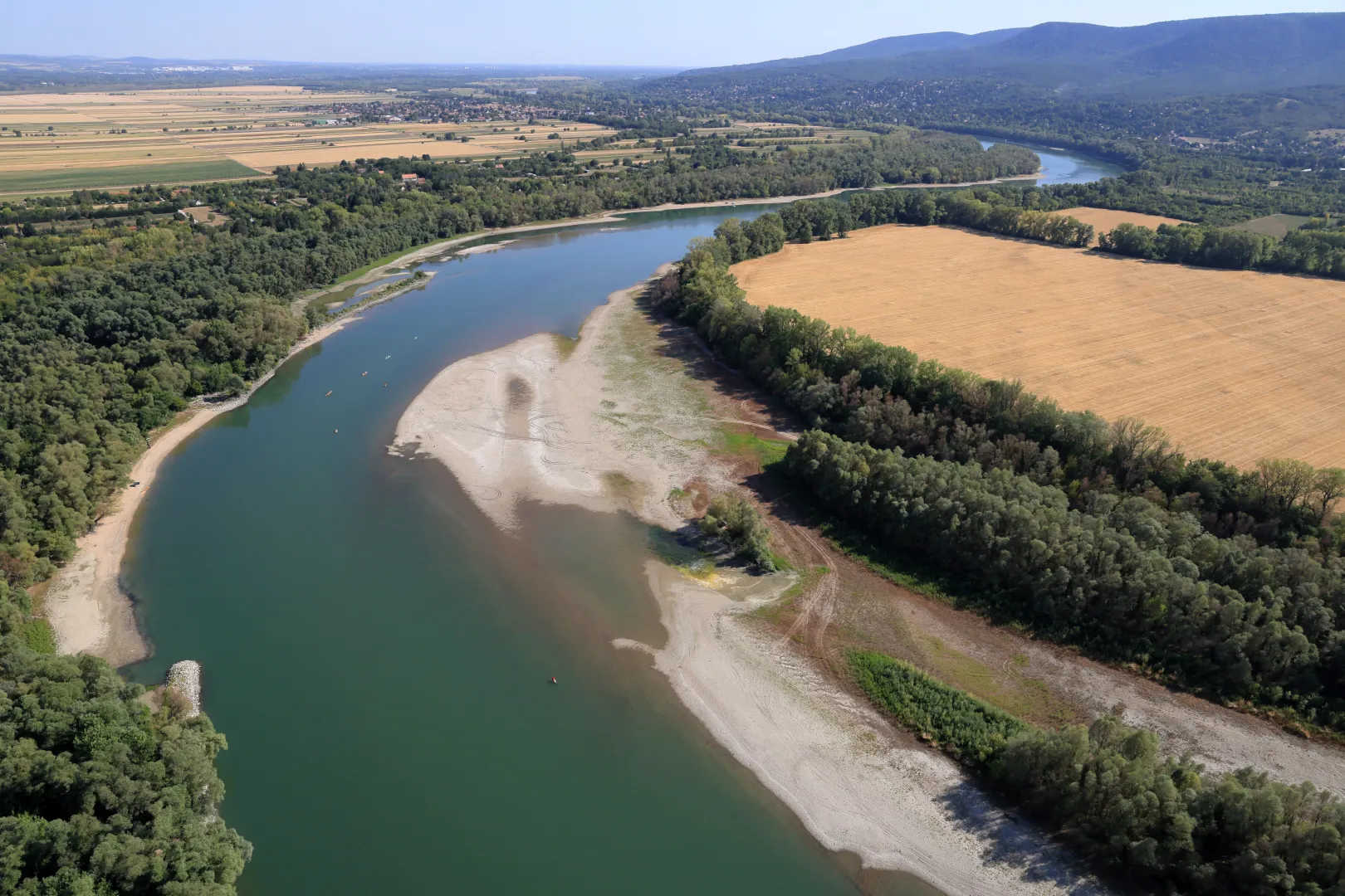
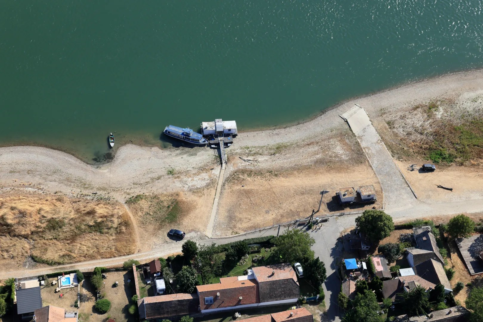
Things weren't looking too good at the Kisoroszi ferry crossing either. Kisoroszi, a village of nearly 1,000 residents located on Szentendre Island, is best known for becoming completely cut off from the outside world by floodwaters almost each time there is major flooding on the Danube. Two years ago, the water level was so high that the road connecting Kisoroszi and Tahitótfalu had to be closed. In recent days, however, 89 percent of the country has been experiencing a moderately severe or severe drought.
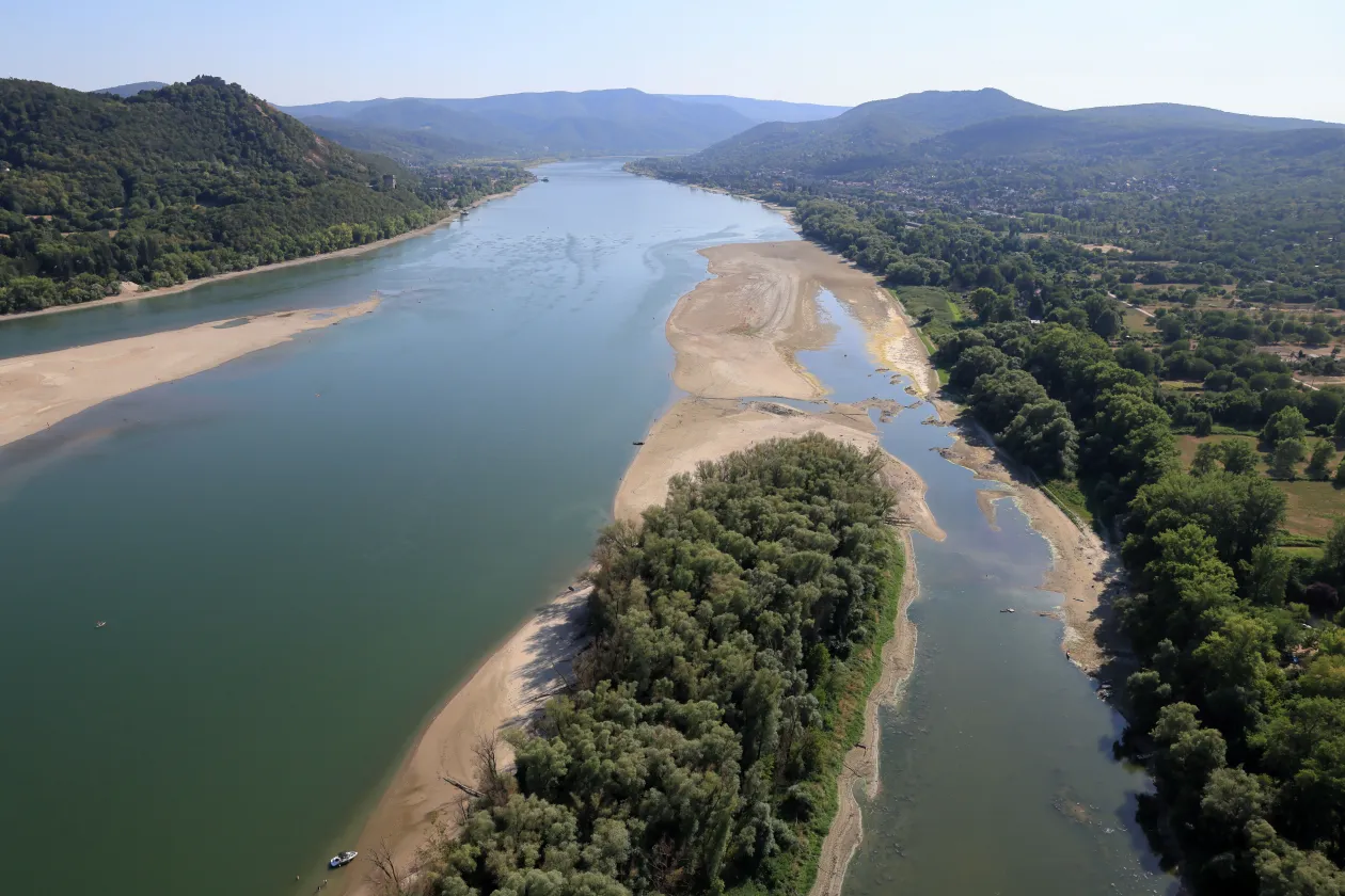
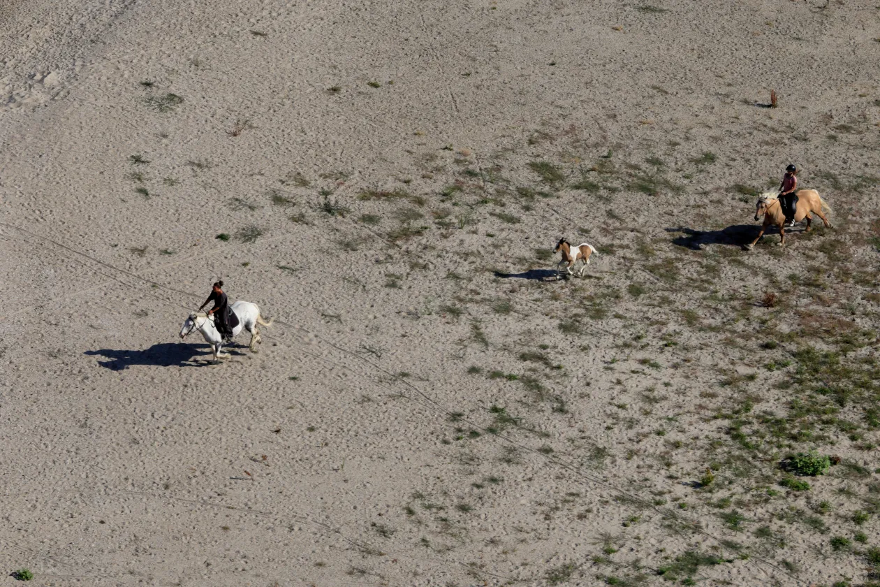
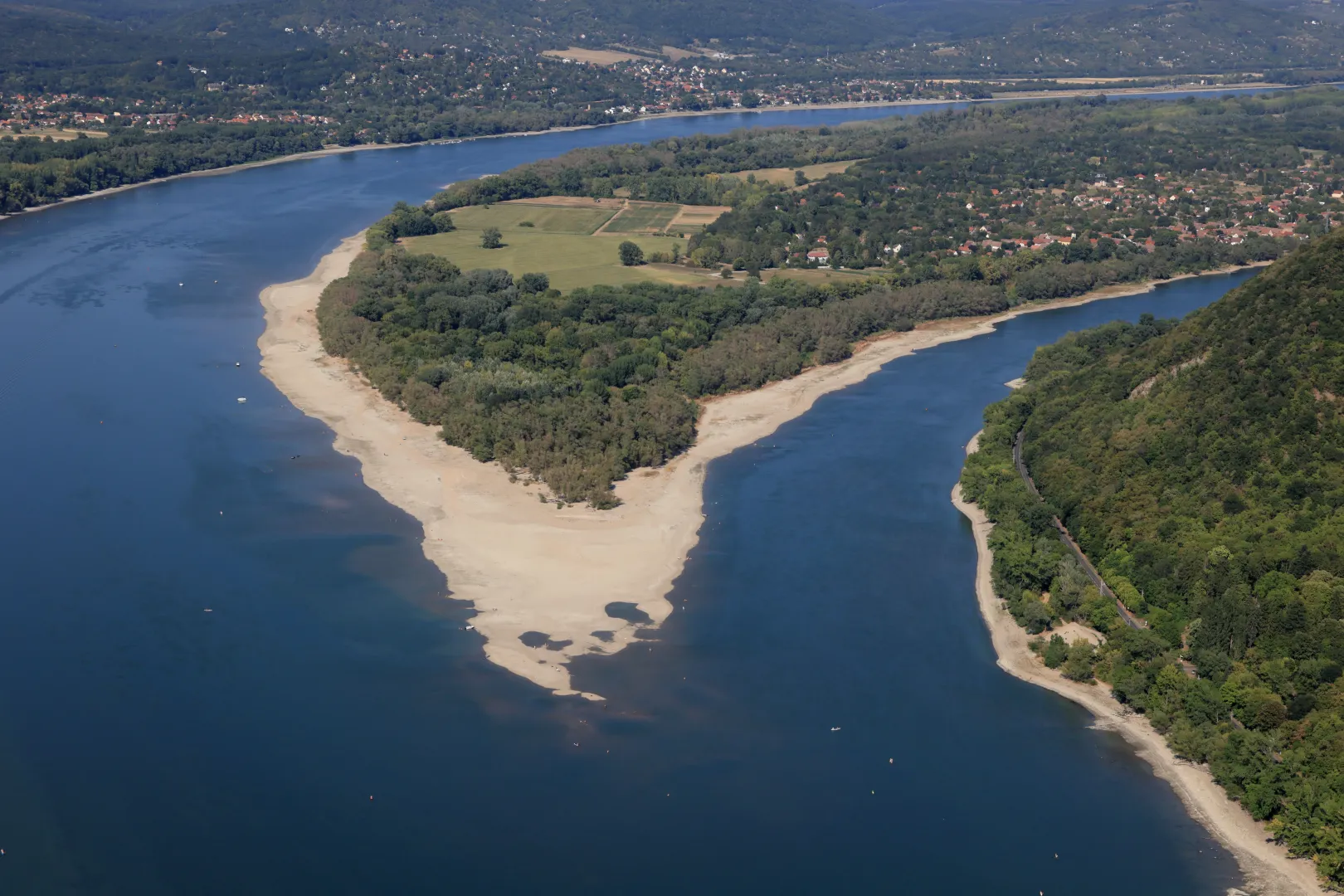
“Whenever I’m flying over the Danube Bend, I always look out for Sólyom Island, located at the northern tip of Szentendre Island. Even during a minor drop in water levels, a fairly large sandbar tends to form here quickly, but I’ve never seen this much exposed land in this spot before. There were beachgoers here too, and from high above, we spotted something moving quite fast. At first we got excited, thinking that there were zebras running around, but as we got closer, it turned out to be just two adult horses and a foal galloping below us.”
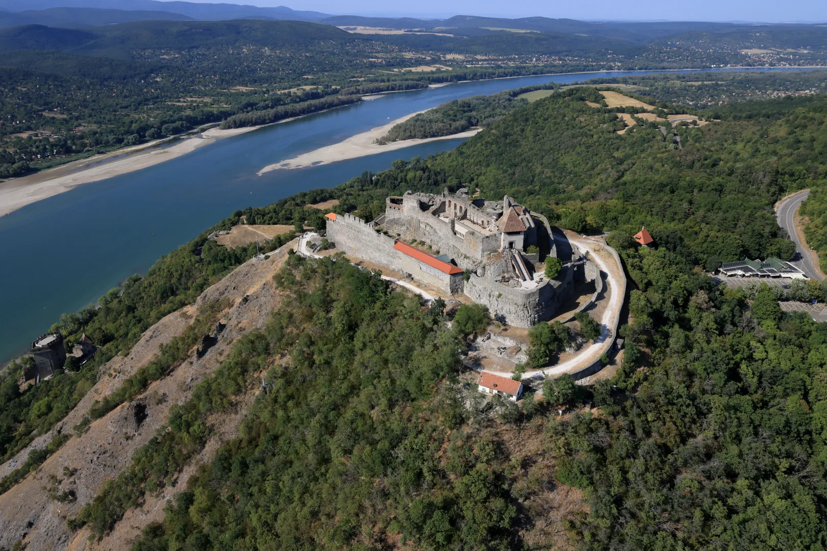
The view from the Visegrád Citadel is truly dramatic. From here, you can see all the way to the tip of Kisoroszi Island. No wonder the town is one of the most popular tourist destinations in the country.
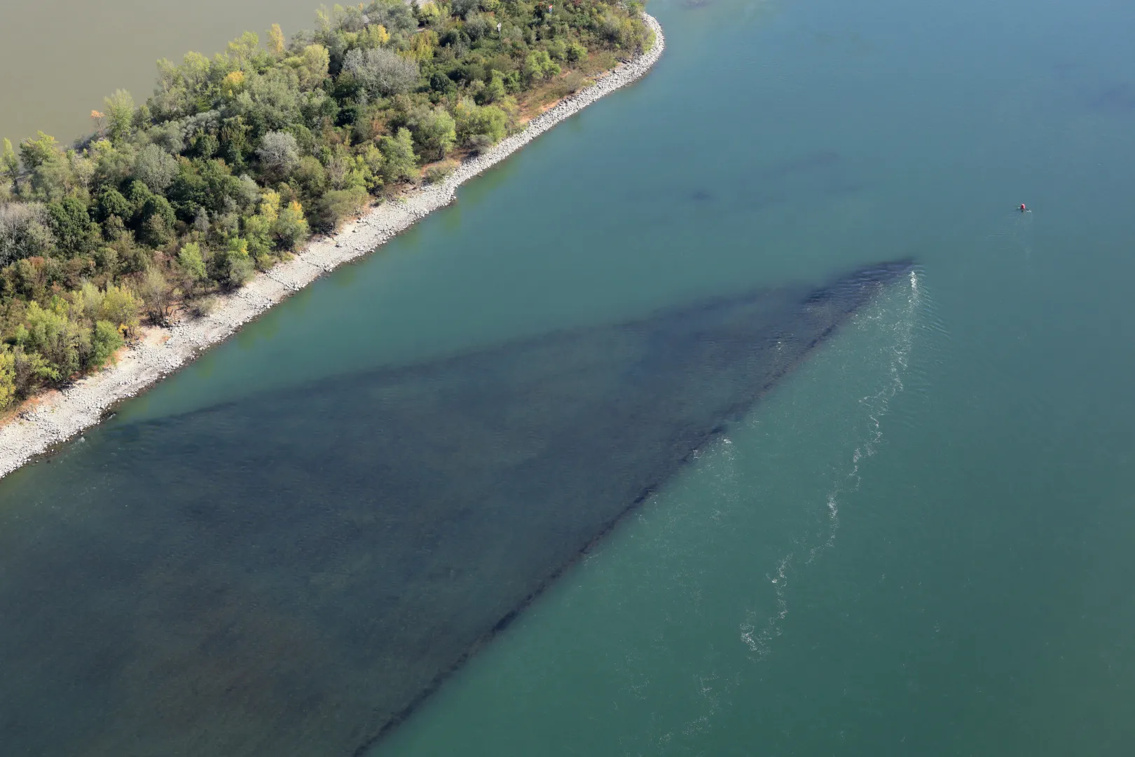
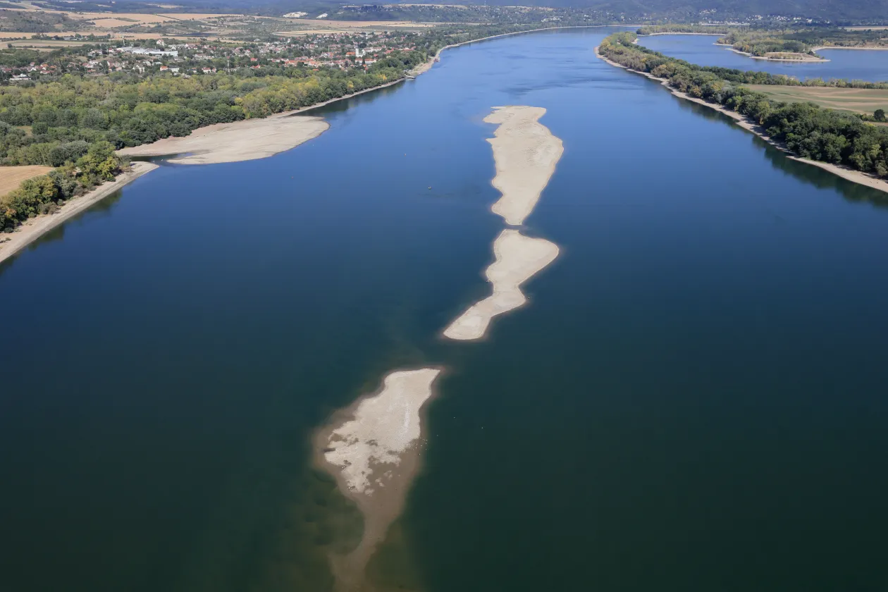
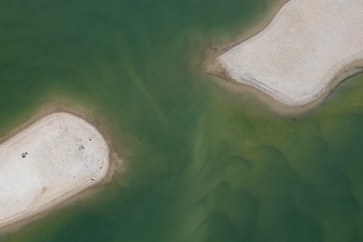
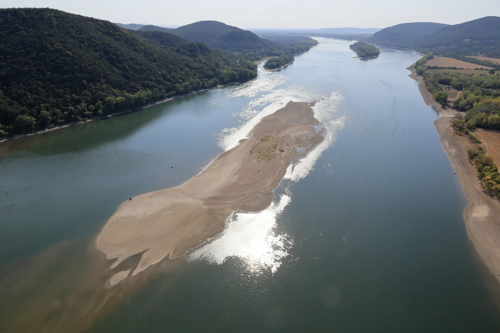
“The sandbar located in front of Sas Hill, halfway between Pilismarót and Esztergom, at the foot of the infamous Hideglelős Cross, becomes visible even during minor droughts, though not nearly as much as now. This part of the landscape is one of my personal favorites.”
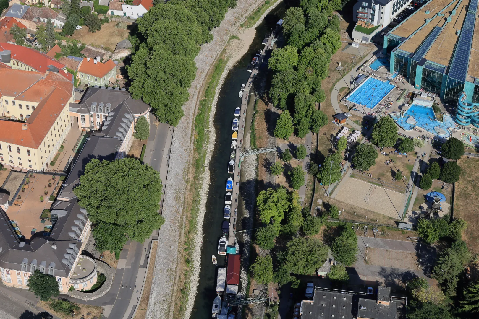
There isn’t much water left in the Little Danube (Kis-Duna) in Esztergom either; the photos clearly show that due to the current water level, the motorboats are neatly parked one behind the other.
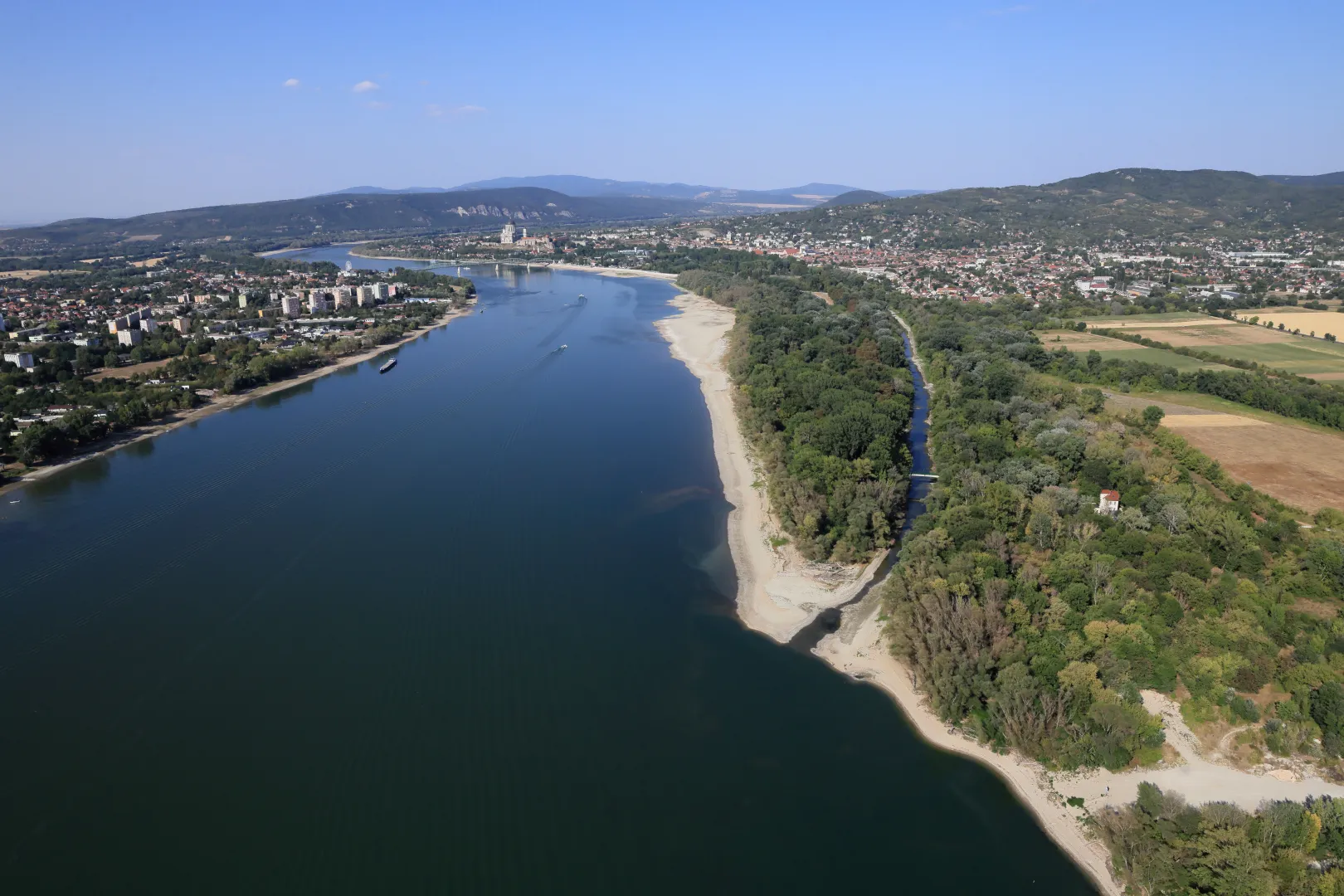
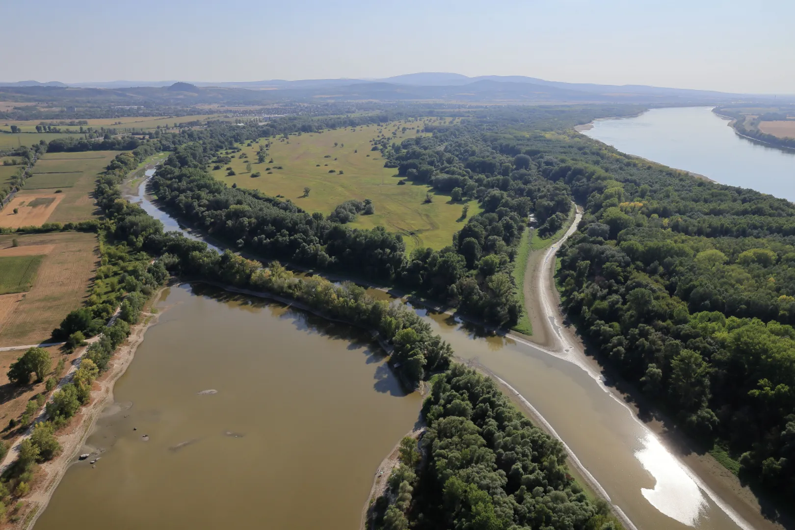
Once we reached the westernmost point of our journey at Prímás Island above Esztergom, we turned around to head home. A small trickle of fresh water could still be seen flowing towards the upper part of the island here.
As a side note, I would like to mention that when I first saw the Danube from an airplane in February 1990, in very gray weather, it was anything but blue. But under the right weather conditions—against the backdrop of a blue sky on clear days—the Danube truly does appear blue, just like every other river and lake in Hungary that I’ve flown over”, Sztraka writes in conclusion.
The situation isn’t only dramatic in Hungary. All of Europe is suffering from the heat. Power plants, factories, and industrial facilities are shutting down or reducing production one after another. Water levels have dropped to dangerously low in several rivers, leading to restrictions or even the suspension of navigation, which is causing billions of euros in damage to the continent’s economy.
We still have some tough days ahead of us though. According to Időkép’s forecast, daytime highs will hover around 40 degrees Celsius in Hungary through Thursday, but midweek temperatures could reach as high as 42 degrees, which would set a new record for the second time this summer. Occasional thunderstorms may develop, and at night, temperatures will only drop to between 20–25 degrees Celsius.